Weather matched to your drone
Wind, gusts, rain and Kp index compared with the limits of the chosen model.
GO/NOGO weather tailored to your drone model, regulated airspace and a 3D preview of the area — all in one place.
Three benefits
Wind, gusts, rain and Kp index compared with the limits of the chosen model.
SIA, RTBA, national parks, Natura 2000: every constraint with its source.
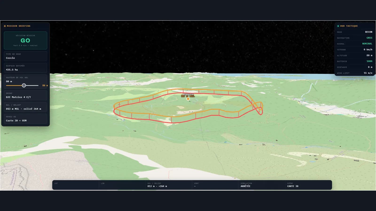
Terrain and airspace volumes around your site.
How it works
No confirmed restriction, weather within limits.
Missing, outdated or ambiguous data: you never see a default GO.
Prohibited area or limit exceeded: always shown first.
3D view
Pricing
To validate your first mission.
or €69.99 incl. VAT / year
7-day trial on first subscription. Cancel at any time for the next billing period; 14-day withdrawal right for consumers (see the Terms of sale, in French).
FAQ
No. Drone OPS Mission is a decision-support tool. The remote pilot must always check the official sources (SIA, NOTAM/AZBA), local restrictions and applicable authorisations before every flight.
The PRO version adds the SIA/RTBA/SUP AIP layers, airspace analysis, sensitive areas, nearby aerodromes, the full GO/NOGO weather briefing, 3D visualisation and traceability to prepare professional or recurring flights.
The platform includes the rules in force: EU Regulation 2019/947, the French Order of 3 December 2020, the open (A1/A2/A3) and specific (STS-01/STS-02) categories and DSAC authorisations with SORA/PDRA. The rule set is versioned and time-stamped for each analysis. This is a decision-support tool: responsibility for the operation remains with the remote pilot.
The open category (subcategories A1, A2, A3) covers low-risk flights with class C0 to C4 drones, without prior authorisation. The specific category covers operations that do not fit the open category, through a STS-01/STS-02 declaration or a DSAC authorisation based on SORA/PDRA.
Drone OPS Mission is optimised for French regulations and SIA airspace. Weather data (OpenMeteo) and the Kp index (NOAA) are available across Europe, but the regulatory analysis relies on French and European (EASA) texts.
The GO/NO-GO engine analyses each rule independently (wind, visibility, airspace, Kp index, flight scenario) and produces a PASS, WARN or FAIL result with the exact regulatory reference. The overall decision is GO, GO_WITH_CONDITIONS or NO_GO. A legal disclaimer is always displayed: final responsibility always lies with the remote pilot.